


Resistivity and Azimuth Gamma: Multi-Physics Formation Evaluation and Reservoir Navigation
Accurate formation evaluation is essential for identifying productive zones and maintaining the desired well trajectory during oil and gas drilling. The Resistivity & Azimuth Gamma tool combines formation resistivity measurements with directional gamma-ray data to provide complementary information about the geological environment surrounding the wellbore.
Formation resistivity helps characterize electrical properties of the surrounding rock and fluids, while azimuthal gamma measurements reveal directional variations in natural gamma radiation. When integrated into a compatible Logging While Drilling (LWD) or Measurement While Drilling (MWD) system, these measurements support formation interpretation, geological boundary identification, and geosteering decisions.
Functional Advantages
Combined Formation Measurements Integrates resistivity and azimuthal gamma measurements to provide complementary electrical and natural gamma-ray information for formation evaluation.
Formation Resistivity Analysis Measures the electrical resistivity response of surrounding formations, helping geologists assess lithology, fluid distribution, and potential reservoir characteristics in combination with other logs.
Directional Gamma-Ray Measurement Captures natural gamma radiation in different circumferential directions, helping identify variations in formation response around the wellbore.
Geological Boundary Identification Combines resistivity and directional gamma data to support the interpretation of formation changes and potential geological boundaries.
Geosteering and Reservoir Navigation Provides additional formation information to help drilling teams evaluate well placement and make informed trajectory adjustments when used with other relevant measurements.
Core Applications
Logging While Drilling (LWD) Acquires formation resistivity and gamma-ray data while drilling, reducing reliance on measurements obtained only after drilling is completed.
Formation Evaluation Supports lithology interpretation and assessment of formation electrical properties using complementary measurement data.
Geosteering Operations Provides geological information to help maintain the planned well trajectory and evaluate formation boundaries.
Reservoir Navigation Supports well placement decisions in complex formations when interpreted alongside geological models and other downhole measurements.
Oil and Gas Exploration and Development Suitable for drilling programs requiring integrated formation evaluation and real-time downhole data acquisition.
How Resistivity & Azimuth Gamma Works
The resistivity measurement system evaluates the electrical response of the surrounding formation. These measurements can help characterize formation properties, although interpretation also depends on factors such as porosity, fluid saturation, lithology, and borehole conditions.
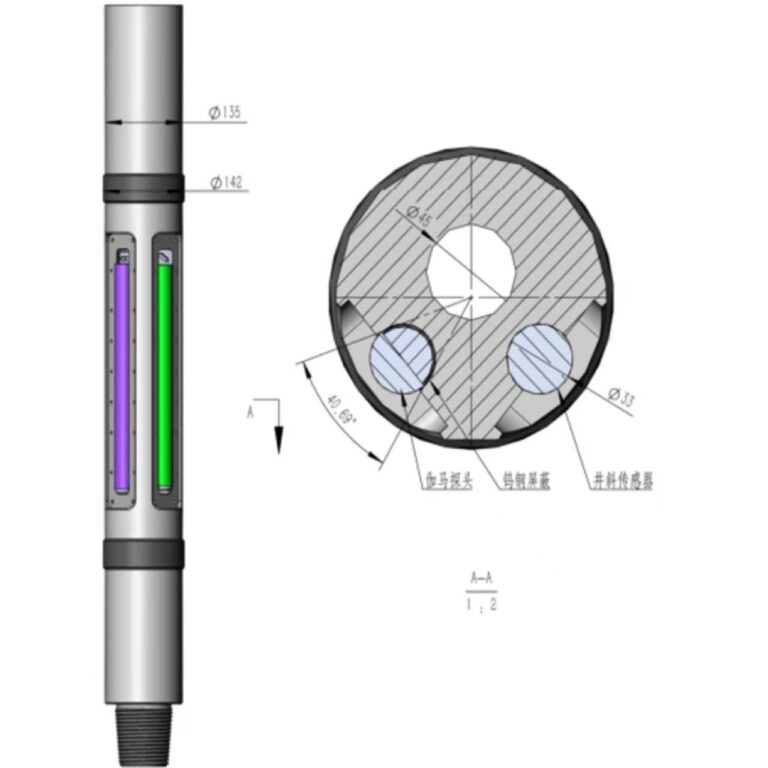
At the same time, the azimuthal gamma sensor measures natural gamma radiation in different directions around the borehole. The directional measurements help reveal circumferential variations in formation response.
By combining these two data sets with tool orientation, drilling parameters, and other available logs, engineers can develop a more comprehensive understanding of the formation and make better-informed geosteering decisions.
Actual measurement capabilities, depth of investigation, resolution, and operating limits depend on the specific tool configuration and LWD system.
Petrogears supplies downhole measurement tools and drilling equipment for oil and gas applications. Technical specifications, system interfaces, and configuration requirements can be discussed according to the customer’s formation-evaluation and drilling objectives.