


Subsurface Attitude Sensing: Magnetometer and Accelerometer Integration in Directional Probes
Steering a wellbore thousands of feet underground requires absolute spatial awareness. Without a clear picture of where the bit is heading in three-dimensional space, hitting a precise geological target is impossible. Measurement While Drilling (MWD) directional probes solve this challenge by continuously measuring the tool’s orientation relative to the Earth’s natural gravity and magnetic fields. Subsurface Attitude Sensing relies on the sophisticated integration of tri-axial magnetometers and accelerometers, transforming raw physical forces into precise inclination, azimuth, and toolface coordinates.
1. The Core Physics of Tri-Axial Sensors
Directional probes utilize orthogonal sets of sensors aligned along the X, Y, and Z axes of the tool body to capture vector data simultaneously.
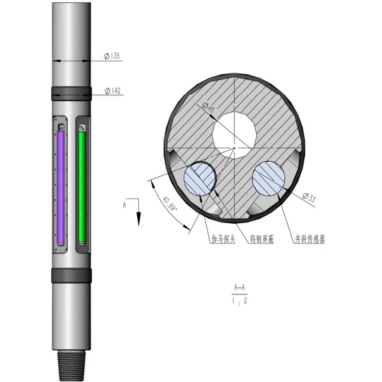
- Accelerometers (Gravity Sensing): Three micro-machined accelerometers measure the force of gravity acting on the tool. By evaluating the proportional distribution of gravitational pull across the X, Y, and Z axes, the system calculates exact inclination (the angle of the borehole relative to vertical) and toolface orientation.
- Magnetometers (Magnetic Field Sensing): Three high-sensitivity magnetometers measure the strength and direction of the Earth’s magnetic field vector. By comparing these magnetic readings against the gravity vector, the probe calculates azimuth (the compass heading or horizontal direction of the wellbore).
2. Mathematical Integration and Vector Math
Raw sensor measurements alone are useless without rigorous vector transformation algorithms running in real time downhole.
- Gravity and Magnetic Vectors: The inclination and toolface are derived directly from the gravity vector components ($G_x, G_y, G_z$). Once inclination and toolface are established, the magnetic vector components ($M_x, M_y, M_z$) are projected onto a horizontal plane to compute true magnetic azimuth.
- Total Magnetic Intensity (TMI) Verification: Modern surveying software cross-references measured magnetic field strength and dip angle against known regional geomagnetic models (like IGRF) to detect localized magnetic anomalies or sensor drift.
3. Environmental Challenges and Mitigation
- Magnetic Interference: Drill string magnetization, nearby casing, and iron-rich formations can distort the Earth’s local magnetic field, causing azimuth errors.
- Temperature and Shock Drift: Extreme downhole temperatures and high-frequency drilling vibrations can induce thermal bias and mechanical stress on sensor crystals. High-end probes utilize specialized temperature compensation algorithms and robust shock-mounting isolation to protect data integrity.
4. Conclusion
Accurate subsurface attitude sensing is the foundation of modern directional drilling. By seamlessly integrating magnetometers and accelerometers, directional probes provide the precision coordinates required to navigate complex laterals and hit target reservoirs with microscopic accuracy.